
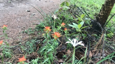
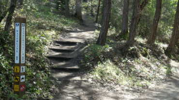
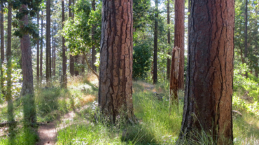
- 3.6 miles - 900 ft of vertical Start at Witzend parking and head south on Waterline and turn right very shortly onto Snark. You’ll be above Ashland Creek for awhile. Snar ...
- 3.6 miles - 900 ft of vertical Start at Witzend parking and head south on Waterline and turn right very shortly onto Snark. You’ll be above Ashland Creek for awhile. Snar ...
- 4.2 miles - 1,300 feet of vertical Park at the Oredson-Todd trailhead near Lupine Dr. This route is not particularly easy to follow. Many of ...
- Distance: 4.4 miles - Min/max elev.: 2204'/3044' - Elev. gain/loss: 871'/-871' - Pedestrian/Mt Bike (uphill-only direction on Wonder) Starting at ...
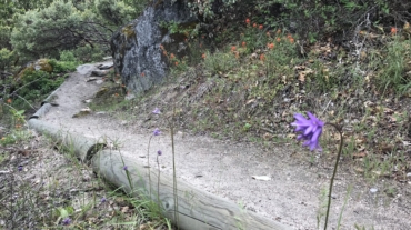
- Distance: 6.5 mi - Min/max elev.: 2215'/3546' - Elev. gain/loss: 1438'/-1438' Head north on Glenview and turn right on Ashland Loop Rd. After a short climb, c ...
- 5.2 miles - 1,600 ft of vertical Starting at Witzend parking, head south on Waterline and turn left up Bandernatch. Follow Bandersnatch and turn right at Red Queen (about ...
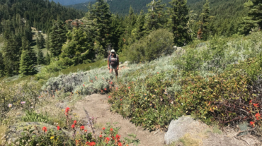
- Distance: ~5.4 miles - Min/max elev.: 6515'/6782' - Elev. gain/loss: 360'/-360' Starting at Mt Ashland, head west through the Mt Ashland parking lot and onto FS Road 20. Aft ...
- 6.1 miles - 1400 ft of vertical Start at Witzend parking and head south on Waterline and turn right very shortly onto Snark. You’ll be above Ashland Creek for awhile. Sna ...
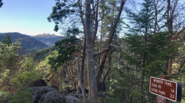
- 7.2 miles - 2,200 of vertical Start at the Fairy Pond TH parking. Head out FS Rd 2060 for ~1.7 miles to Wonder. Head up Wonder until reachin ...
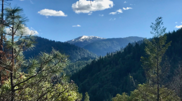
- Distance: ~8 miles - Min/max elev.: 2200'/3550' - Elev. gain/loss: 1660'/-1660' Starting from the Fairy Ponds trail head, follow Wonder 4-miles up all the way ...
- Distance: 8.2 miles - Min/max elev.: 2011'/3547' - Elev. gain/loss: 1699'/-1699 This is a pedestrian and mt bike route.From the Fairy Ponds TH, head north on ...
- Distance: 8.5 miles - Min/max elev.: 6515'/7186' - Elev. gain/loss: 1023'/-1023' Starting at Mt Ashland, head west through the Mt Ashland parking lot and onto ...
- Distance: 8.9 miles - Min/max elev.: 2217'/3407' - Elev. gain/loss: 2300'/-2300' Starting at Witzend, head out Waterline, up Bandersnatch, turn right at Red Q ...
- Distance: 9.1 miles - Min/max elev.: 2216'/3852' - Elev. gain/loss: 2038'/-2038' Starting at Witzend TH, head out Waterline, up Bandersnatch, turn right at Red Queen. At the ...
- Distance: 9.4 miles - Min/max elev.: 6519'/7187' - Elev. gain/loss: 2381'/-2381' Head north from the Split Rock TH and climb the occasionally faint and narrow ...
- Distance: 9.6 miles - Min/max elev.: 2011'/4041' - Elev. gain/loss: 2128'/-2128' - Pedestrian and Mt BikeStarting at Fairy Ponds TH, head out FS Rd 2060 for ~4.9 miles. Tur ...
- Distance: 10.6 miles - Min/max elev.: 2217'/4375' - Elev. gain/loss: 2445'/-2445' Starting at Witzend, head out Waterline, up Bandersnatch, turn right at Red ...