
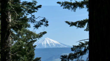
"Beware the Jubjub bird, and shunThe frumious Bandersnatch!” (from the poem Jabberwocky in Through the Looking-Glass and What Alice Found There, 1872) Description – Distance: ~ ...
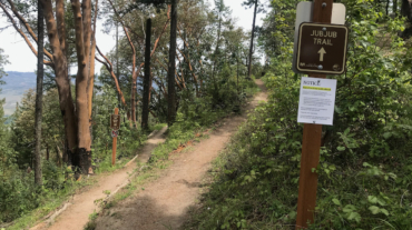
"Beware the Jubjub bird, and shunThe frumious Bandersnatch!” (from the poem Jabberwocky in Through the Looking-Glass and What Alice Found There, 1872) Description – Distance: ~ ...
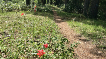
"The Jabberwock, with eyes of flame, Came whiffling through the tulgey wood," (from the poem Jabberwocky in Through the Looking-Glass and What Alice Found There, 1872) Descript ...
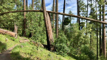
Description – Distance: ~ 1.25 miles – Min/max elev.: 4190’/4694′ – Elev. gain/loss: 119’/-623′ Click here for routes and maps with Horn Gap Trail. Horn Gap Trail connects o ...
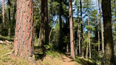
Description – Distance: ~ 4.4 miles – Min/max elev.: 3666’/4529′ – Elev. gain/loss: 1373’/-510′ Click here for routes and maps with Horn Gap Rd. Horn Gap Rd, also known as F ...
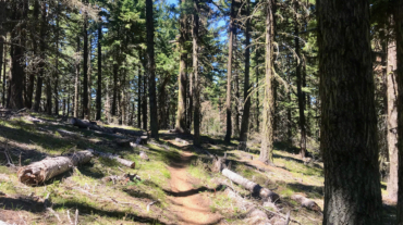
Description – Distance: ~3.3 miles – Min/max elev.: 4023’/4732′ – Elev. gain/loss: 232’/-1935′ Click here for routes and maps with Hitt Rd. Hitt Rd starts--at the low end--at ...
Description – Distance: ~1.3 miles – Min/max elev.: 5388’/5711′ – Elev. gain/loss: 449’/-85′ Click here for routes and maps with Corp Camp trail/road. Corp Camp is a road that ...
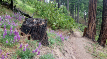
’Twas brillig, and the slithy toves Did gyre and gimble in the wabe: All mimsy were the borogoves, And the mome raths outgrabe.-- In Jabberwocky, a poem in Through the Lookin ...
’Twas brillig, and the slithy toves Did gyre and gimble in the wabe: All mimsy were the borogoves, And the mome raths outgrabe.-- In Jabberwocky, a poem in Through the Lookin ...
Description – Distance: ~1.5 miles – Min/max elev.: 4731’/5060′ – Elev. gain/loss: 502’/-180′ Click here for routes and maps of Upper Eastview trail. Upper East ...
Description – Distance: ~2.4 miles – Min/max elev.: 4023’/4732′ – Elev. gain/loss: 811’/-194′ Click here for routes and maps of Eastview trail. Eastview is a multi-use trail t ...
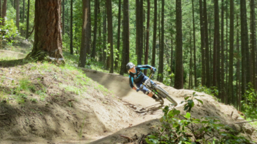
Description – Distance: ~1.6 miles – Min/max elev.: 3422’/4367′ – Elev. gain/loss: 994’/-50′ Click here for routes and maps of Catwalk trail. Catwalk is a popular downhill mou ...
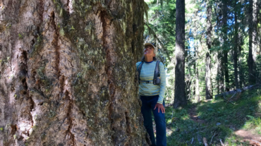
In a minute or two the Caterpillar took the hookah out of its mouth and yawned once or twice, and shook itself. Then it got down off the mushroom, and crawled away in the grass, m ...
Description – Distance: ~2.9 miles – Min/max elev.: 5367’/5840′ – Elev. gain/loss: 628’/-486′ Click here for routes and maps with Lower Bull Gap trail. Lower Bull Gap is a mul ...
Description – Distance: ~2.5 miles – Min/max elev.: 5509’/6578′ – Elev. gain/loss: 1116’/-47′ Click here for routes and maps with Bull Gap trail. Bull Gap trail is a multi-use ...
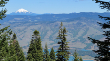
"Just the place for a Snark! I have said it twice:That alone should encourage the crew.Just the place for a Snark! I have said it thrice:What I tell you three times is true." - Hu ...
Description – Distance: ~ 1.8 miles – Min/max elev.: 3264’/3827′ – Elev. gain/loss: 394’/-847′ Click here for routes and maps with Fell on Knee trail. Fell on Knee is a mult ...