
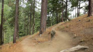
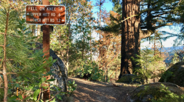
- Distance: 2.8 miles - Min/max elev.: 2217'/2971' - Elev. gain/loss: 810'/-810' Starting at Witzend parking, head south on Waterline and turn left up Bandernat ...
- Distance: 2.8 miles - Min/max elev.: 2217'/2971' - Elev. gain/loss: 810'/-810' Starting at Witzend parking, head south on Waterline and turn left up Bandernat ...
- 3.1 miles - 870 ft of vertical Start at Witzend parking and head south on Waterline and turn right very shortly onto Snark. You’ll be above Ashland Creek for awhile. Snar ...
- Distance: 4.4 miles - Min/max elev.: 2204'/3044' - Elev. gain/loss: 871'/-871' - Pedestrian/Mt Bike (uphill-only direction on Wonder) Starting at ...
- 5.2 miles - 1,600 ft of vertical Starting at Witzend parking, head south on Waterline and turn left up Bandernatch. Follow Bandersnatch and turn right at Red Queen (about ...
- 7.2 miles - 2,200 of vertical Start at the Fairy Pond TH parking. Head out FS Rd 2060 for ~1.7 miles to Wonder. Head up Wonder until reachin ...
- Distance: 8.2 miles - Min/max elev.: 2011'/3547' - Elev. gain/loss: 1699'/-1699 This is a pedestrian and mt bike route.From the Fairy Ponds TH, head north on ...
- Distance: 9.6 miles - Min/max elev.: 2011'/4041' - Elev. gain/loss: 2128'/-2128' - Pedestrian and Mt BikeStarting at Fairy Ponds TH, head out FS Rd 2060 for ~4.9 miles. Tur ...
- Distance: 10.8 miles - Min/max elev.: 2011'/4252' - Elev. gain/loss: 2423'/-2423' - Pedestrian and Mt Bike From the Fairy Ponds TH, head south out FS Rd ...
- Distance: 11.5 miles - Min/max elev.: 2189'/4041' - Elev. gain/loss: 2731'/-2731' This is mostly for runners who are looking for multiple uphill-downhill sect ...
- Distance: 14.5 miles - Min/max elev.: 2201'/4882' - Elev. gain/loss: 2785'/-2785' - Pedestrian and Mt Bike Starting at Fairy Ponds TH, head out FS Rd 2060 for ~1.7 miles to ...

- Distance: 14.6 mi - Min/max elev.: 2189'/4041' - Elev. gain/loss: 3142'/-3142' Starting at Witzend TH, head south on Glenview and then left at Granite St to join FS Rd 2060 ...
- Distance: 15.2 miles - Min/max elev.: 2011'/4252' - Elev. gain/loss: 3600'/-3600' This route is mt bike and pedestrian. NOTE: bikes must ride up Wonder. More description ...
- Distance: 15.7 miles - Min/max elev.: 2213'/4882' - Elev. gain/loss: 3070'/-3070' This is a pedestrian and mountain bike route. From Fairy P ...

- Distance: 18 miles - Min/max elev.: 2212'/4915' - Elev. gain/loss: 3115'/-3115' - Pedestrian, Mt Biking Starting at Fairy Ponds TH, head out FS Rd 2060 ...
- Distance: 18.1 miles - Min/max elev.: 2209'/4915' - Elev. gain/loss: 3076'/-3076' - Pedestrian and Mt BikeStarting at Fairy Ponds TH, head out FS Rd 206 ...
– Distance: 25 miles
– Min/max elev.: 2189’/4950′
– Elev. gain/loss: 3382’/-3382′
This is the simple, road-based route around the watershed, using mostly FS-2060 and the Ashland Loop Rd, counter clockwise.…