
- Distance: 1.1 miles - Min/max elev.: 2208'/2511' - Elev. gain/loss: 300'/-300' - Mt Bike Loop starting on a multi-use trail (Wonder) From the Fairy Pond ...
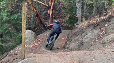
- Distance: 1.1 miles - Min/max elev.: 2208'/2511' - Elev. gain/loss: 300'/-300' - Mt Bike Loop starting on a multi-use trail (Wonder) From the Fairy Pond ...

- Distance: 2 miles - Min/max elev.: 2208'/2713' - Elev. gain/loss: 530'/-530' - Mt Bike Loop starting on a multi-use trail (Wonder) From the Fairy Ponds ...
- Distance: 2.6 miles - Min/max elev.: 2217'/2733' - Elev. gain/loss: 641'/-641' Start at Witzend parking and head south on Waterline and turn right very shortly onto Sn ...
- 2.6 mile - 1000 ft of vertical Starting at Witzend parking, head south on Waterline and turn left up Bandernatch. Follow Bandersnatch all th ...
- 3.1 miles - 870 ft of vertical Start at Witzend parking and head south on Waterline and turn right very shortly onto Snark. You’ll be above Ashland Creek for awhile. Snar ...
- Distance: 3.2 miles - Min/max elev.: 2328'/3255' - Elev. gain/loss: 901'/-901' Description coming eventually...but the map ...
- Distance: 3.4 miles - Min/max elev.: 3175'/3852' - Elev. gain/loss: 732'/-732' This route starts and ends gently, but has a good steep climb in the middle. Start up the Whit ...
- 3.6 miles - 900 ft of vertical Start at Witzend parking and head south on Waterline and turn right very shortly onto Snark. You’ll be above Ashland Creek for awhile. Snar ...
- 4.2 miles - 1,300 feet of vertical Park at the Oredson-Todd trailhead near Lupine Dr. This route is not particularly easy to follow. Many of ...
- Distance: 4.4 miles - Min/max elev.: 2204'/3044' - Elev. gain/loss: 871'/-871' - Pedestrian/Mt Bike (uphill-only direction on Wonder) Starting at ...
- Distance: 6.5 mi - Min/max elev.: 2215'/3546' - Elev. gain/loss: 1438'/-1438' Head north on Glenview and turn right on Ashland Loop Rd. After a short climb, c ...
- 5.2 miles - 1,600 ft of vertical Starting at Witzend parking, head south on Waterline and turn left up Bandernatch. Follow Bandersnatch and turn right at Red Queen (about ...
- 6.1 miles - 1400 ft of vertical Start at Witzend parking and head south on Waterline and turn right very shortly onto Snark. You’ll be above Ashland Creek for awhile. Sna ...
- 7.2 miles - 2,200 of vertical Start at the Fairy Pond TH parking. Head out FS Rd 2060 for ~1.7 miles to Wonder. Head up Wonder until reachin ...
- Distance: 8.2 miles - Min/max elev.: 2011'/3547' - Elev. gain/loss: 1699'/-1699 This is a pedestrian and mt bike route.From the Fairy Ponds TH, head north on ...
- Distance: 8.9 miles - Min/max elev.: 2217'/3407' - Elev. gain/loss: 2300'/-2300' Starting at Witzend, head out Waterline, up Bandersnatch, turn right at Red Q ...