
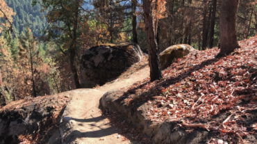
- Distance: 1.1 miles - Min/max elev.: 2208'/2511' - Elev. gain/loss: 300'/-300' - Mt Bike Loop starting on a multi-use trail (Wonder) From the Fairy Pond ...
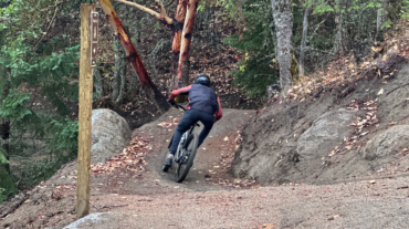
- Distance: 1.1 miles - Min/max elev.: 2208'/2511' - Elev. gain/loss: 300'/-300' - Mt Bike Loop starting on a multi-use trail (Wonder) From the Fairy Pond ...

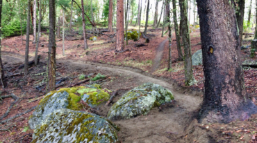
- Distance: 2 miles - Min/max elev.: 2208'/2713' - Elev. gain/loss: 530'/-530' - Mt Bike Loop starting on a multi-use trail (Wonder) From the Fairy Ponds ...
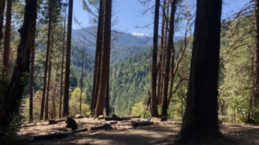
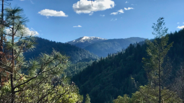
“Always be on the lookout for the presence of wonder.”E.B. White Description – Distance: ~ 2.8 miles – Min/max elev.: 2206’/3054′ – Elev. gain/loss: 1510’/-747′ Click here f ...
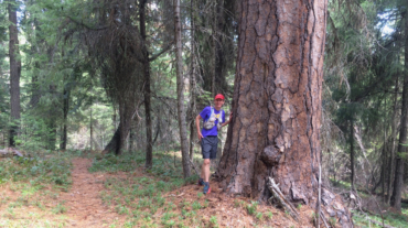
- Distance: 4.4 miles - Min/max elev.: 2204'/3044' - Elev. gain/loss: 871'/-871' - Pedestrian/Mt Bike (uphill-only direction on Wonder) Starting at ...
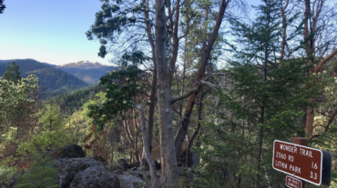
- 7.2 miles - 2,200 of vertical Start at the Fairy Pond TH parking. Head out FS Rd 2060 for ~1.7 miles to Wonder. Head up Wonder until reachin ...
- Distance: ~8 miles - Min/max elev.: 2200'/3550' - Elev. gain/loss: 1660'/-1660' Starting from the Fairy Ponds trail head, follow Wonder 4-miles up all the way ...
- Distance: 8.2 miles - Min/max elev.: 2011'/3547' - Elev. gain/loss: 1699'/-1699 This is a pedestrian and mt bike route.From the Fairy Ponds TH, head north on ...
- Distance: 10.8 miles - Min/max elev.: 2011'/4252' - Elev. gain/loss: 2423'/-2423' - Pedestrian and Mt Bike From the Fairy Ponds TH, head south out FS Rd ...
- Distance: 14.5 miles - Min/max elev.: 2201'/4882' - Elev. gain/loss: 2785'/-2785' - Pedestrian and Mt Bike Starting at Fairy Ponds TH, head out FS Rd 2060 for ~1.7 miles to ...
- Distance: 15.2 miles - Min/max elev.: 2011'/4252' - Elev. gain/loss: 3600'/-3600' This route is mt bike and pedestrian. NOTE: bikes must ride up Wonder. More description ...
- Distance: 15.5 miles - Min/max elev.: 2205'/4882' - Elev. gain/loss: 3148'/-3148' - Pedestrian, Mt Bike Starting at Fairy Ponds TH, head out FS Rd 2060 ...
- Distance: 15.7 miles - Min/max elev.: 2213'/4882' - Elev. gain/loss: 3070'/-3070' This is a pedestrian and mountain bike route. From Fairy P ...

- Distance: 18 miles - Min/max elev.: 2212'/4915' - Elev. gain/loss: 3115'/-3115' - Pedestrian, Mt Biking Starting at Fairy Ponds TH, head out FS Rd 2060 ...
- Distance: 18.1 miles - Min/max elev.: 2209'/4915' - Elev. gain/loss: 3076'/-3076' - Pedestrian and Mt BikeStarting at Fairy Ponds TH, head out FS Rd 206 ...
- Distance: 20.5 miles - Min/max elev.: 2204'/4915' - Elev. gain/loss: 3689'/-3689' Starting at Fairy Ponds TH, head southwest out FS Rd 2060 for ~3.6 mil ...
– Distance: 25 miles
– Min/max elev.: 2189’/4950′
– Elev. gain/loss: 3382’/-3382′
This is the simple, road-based route around the watershed, using mostly FS-2060 and the Ashland Loop Rd, counter clockwise.…