
- Distance: 6.5 mi - Min/max elev.: 2215'/3546' - Elev. gain/loss: 1438'/-1438' Head north on Glenview and turn right on Ashland Loop Rd. After a short climb, c ...
- Distance: 6.5 mi - Min/max elev.: 2215'/3546' - Elev. gain/loss: 1438'/-1438' Head north on Glenview and turn right on Ashland Loop Rd. After a short climb, c ...
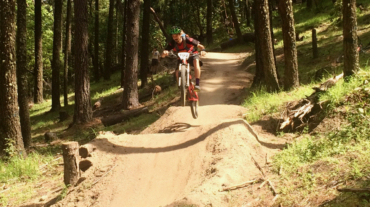
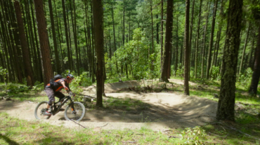
- Distance: 11.8 miles - Min/max elev.: 2217'/6569' - Elev. gain/loss: 609'/-4961' This is a mostly downhill ride with a smorgasbord of cro ...
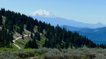
- Distance: 14.8 miles - Min/max elev.: 2217'/7016' - Elev. gain/loss: 675'/-5021' Starting at Mt Ashland, head west through the Mt Ashland parking lot and onto ...