
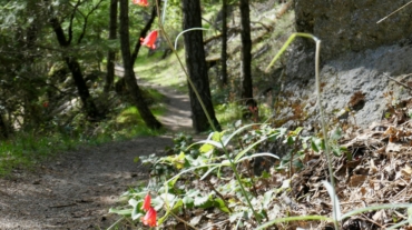
Now, here, you see, it takes all the running you can do, to keep in the same place. If you want to get somewhere else, you must run at least twice as fast as that! – Red Queen i ...
Now, here, you see, it takes all the running you can do, to keep in the same place. If you want to get somewhere else, you must run at least twice as fast as that! – Red Queen i ...
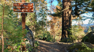
- Distance: 2.1 miles - Min/max elev.: 2426'/2971' - Elev. gain/loss: 581'/-581' From the Lower Red Queen TH, head up to the intersection with BTI and Red Queen. Cross BTI ...
- Distance: 3.1 miles - Min/max elev.: 2762'/3359' - Elev. gain/loss: 704'/-704' From White Rabbit TH, head north on White Rabbit and then turn right onto Caterpillar trail (w ...
- 5.2 miles - 1,600 ft of vertical Starting at Witzend parking, head south on Waterline and turn left up Bandernatch. Follow Bandersnatch and turn right at Red Queen (about ...
- 6.1 miles - 1400 ft of vertical Start at Witzend parking and head south on Waterline and turn right very shortly onto Snark. You’ll be above Ashland Creek for awhile. Sna ...
- Distance: 8.9 miles - Min/max elev.: 2217'/3407' - Elev. gain/loss: 2300'/-2300' Starting at Witzend, head out Waterline, up Bandersnatch, turn right at Red Q ...
- Distance: 9.1 miles - Min/max elev.: 2216'/3852' - Elev. gain/loss: 2038'/-2038' Starting at Witzend TH, head out Waterline, up Bandersnatch, turn right at Red Queen. At the ...
- Distance: 10.6 miles - Min/max elev.: 2217'/4375' - Elev. gain/loss: 2445'/-2445' Starting at Witzend, head out Waterline, up Bandersnatch, turn right at Red ...
- Distance: 11.5 miles - Min/max elev.: 2189'/4041' - Elev. gain/loss: 2731'/-2731' This is mostly for runners who are looking for multiple uphill-downhill sect ...

- Distance: 14.6 mi - Min/max elev.: 2189'/4041' - Elev. gain/loss: 3142'/-3142' Starting at Witzend TH, head south on Glenview and then left at Granite St to join FS Rd 2060 ...
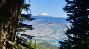
- Distance: 23.9 miles - Min/max elev.: 2215'/5848' - Elev. gain/loss: 4270'/-4270' Starting at Witzend, head out Waterline, up Bandersnatch, turn right at Red Queen. At the t ...
- Distance: 26.2 miles - Min/max elev.: 1946'/4930' - Elev. gain/loss: 3861'/-3861' Download the GPX file or zoom in to see turns of this clas ...