
"Just the place for a Snark! I have said it twice:That alone should encourage the crew.Just the place for a Snark! I have said it thrice:What I tell you three times is true." - Hu ...
"Just the place for a Snark! I have said it twice:That alone should encourage the crew.Just the place for a Snark! I have said it thrice:What I tell you three times is true." - Hu ...
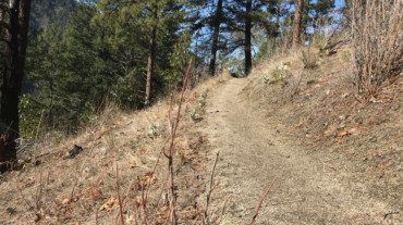
- Distance: 2.6 miles - Min/max elev.: 2217'/2733' - Elev. gain/loss: 641'/-641' Start at Witzend parking and head south on Waterline and turn right very shortly onto Sn ...
- 3.1 miles - 870 ft of vertical Start at Witzend parking and head south on Waterline and turn right very shortly onto Snark. You’ll be above Ashland Creek for awhile. Snar ...
- 3.6 miles - 900 ft of vertical Start at Witzend parking and head south on Waterline and turn right very shortly onto Snark. You’ll be above Ashland Creek for awhile. Snar ...
- 6.1 miles - 1400 ft of vertical Start at Witzend parking and head south on Waterline and turn right very shortly onto Snark. You’ll be above Ashland Creek for awhile. Sna ...

- Distance: 14.6 mi - Min/max elev.: 2189'/4041' - Elev. gain/loss: 3142'/-3142' Starting at Witzend TH, head south on Glenview and then left at Granite St to join FS Rd 2060 ...