
– Distance: 4 miles – Min/max elev.: 2216'/3173' – Elev. gain/loss: 940'/-940' From Witzend Trailhead parking, head north out Glenview and right up Ashland L ...
– Distance: 4 miles – Min/max elev.: 2216'/3173' – Elev. gain/loss: 940'/-940' From Witzend Trailhead parking, head north out Glenview and right up Ashland L ...
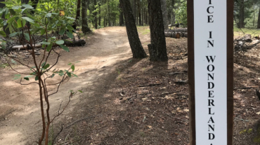
Description – Distance: ~ 2.1 miles – Min/max elev.: 2483’/3300′ – Elev. gain/loss: 1094’/-416′ Click here for routes and maps with White Rabbi ...
Description – Distance: ~ .25 miles – Min/max elev.: 3179’/3327′ – Elev. gain/loss: 3’/-150′ Click here for routes and maps with Rabbit Hole trail. Rabbit Hole is a short bi ...
- Distance: 1.8 miles - Min/max elev.: 3074'/3407' - Elev. gain/loss: 480'/-480' From White Rabbit TH, head out White Rabbit. Turn left at the intersection with ...
- Distance: 3.1 miles - Min/max elev.: 2762'/3359' - Elev. gain/loss: 704'/-704' From White Rabbit TH, head north on White Rabbit and then turn right onto Caterpillar trail (w ...
- Distance: 3.4 miles - Min/max elev.: 3175'/3852' - Elev. gain/loss: 732'/-732' This route starts and ends gently, but has a good steep climb in the middle. Start up the Whit ...