
Description
– Distance: ~1 miles
– Min/max elev.: 3200’/3520′
– Elev. gain/loss: 230’/-400′
Click here for routes and maps with Toothpick trail.
The Toothpick trail is flat to gentle rolling from FS 2060 to Catwalk Trail and then descends–steeply in parts–to Tolman Creek Road. Toothpick connects to Catwalk and Caterpillar trails as well as the Lamb Mine trail, so various loops and out and back routes are possible.
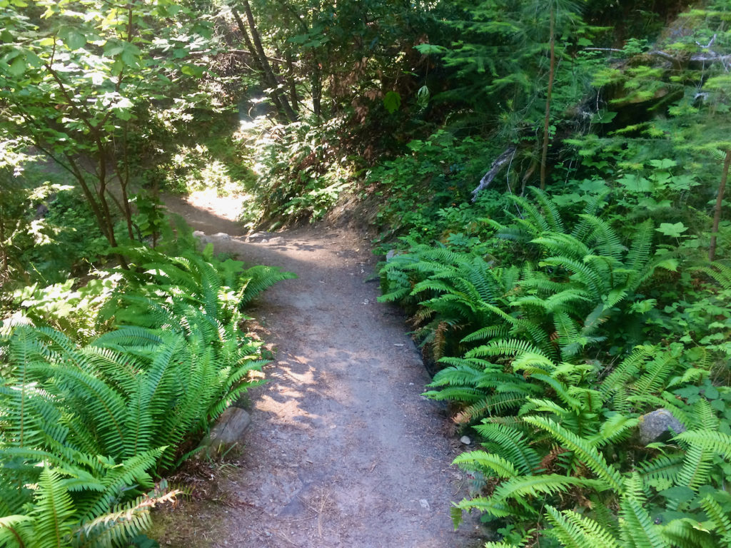
Toothpick is often cool when other trails are hot. Lush ferns and large ponderosas and douglas firs populate the sides of the trail. Views of Ashland and Mt. Mcloughlin poke through in places.
This is a popular hiking and mountain biking trail. Bikers descending from Mt. Ashland often use this trail (after Catwalk) and will often show up in groups, so pedestrians may experience a bolus of bikers and then none. Keep your head up and your headphones off. Equestrians use this trail occasionally.
Toothpick is not depicted going all the way to Tolman Creek Rd on this map to honor an agreement with the private property owner whose property this trail traverses.
History
According to historian Jeff Lalande, the Toothpick and Lamb Mine trails follow a three-mile long ditch that diverted water from the East Fork of Ashland Creek to a stamp mill on the Tolman Creek/Hamilton Creek divide. Some of the lower part of Toothpick is a jeep road that led to the (very short-lived/unproductive) 1950s Mt. Pittview Mine (Mt Pitt is the old name for Mt Mcloughlin).
In the 1960s and ‘70s, the trail may have acquired the “Toothpick” name from the numerous small-diameter Douglas-firs that grew near the trail. The trees were apparently so densely packed, you could hardly walk through them and thus they probably were “suppressed”, small-trunked and vertical—like toothpicks.
Written by Torsten Heycke 05/16/2020