
Description
– Distance: ~ 2.2 miles
– Min/max elev.: 4905’/6623′
– Elev. gain/loss: 1855’/-140′
Click here for routes and maps with Wagner Glade trail.
The pedestrian-only Wagner Glade trail connects FS RD 2060 with the Wagner Butte and Split Rock Trails. The trail climbs gently at first through large groves of Ponderosa and Doug firs and then heads more steeply up to the Wagner Glade Gap. The trail offers many excellent views of the Rogue Valley, Mt Mcloughlin, Mt Ashland and the Ashland Watershed.
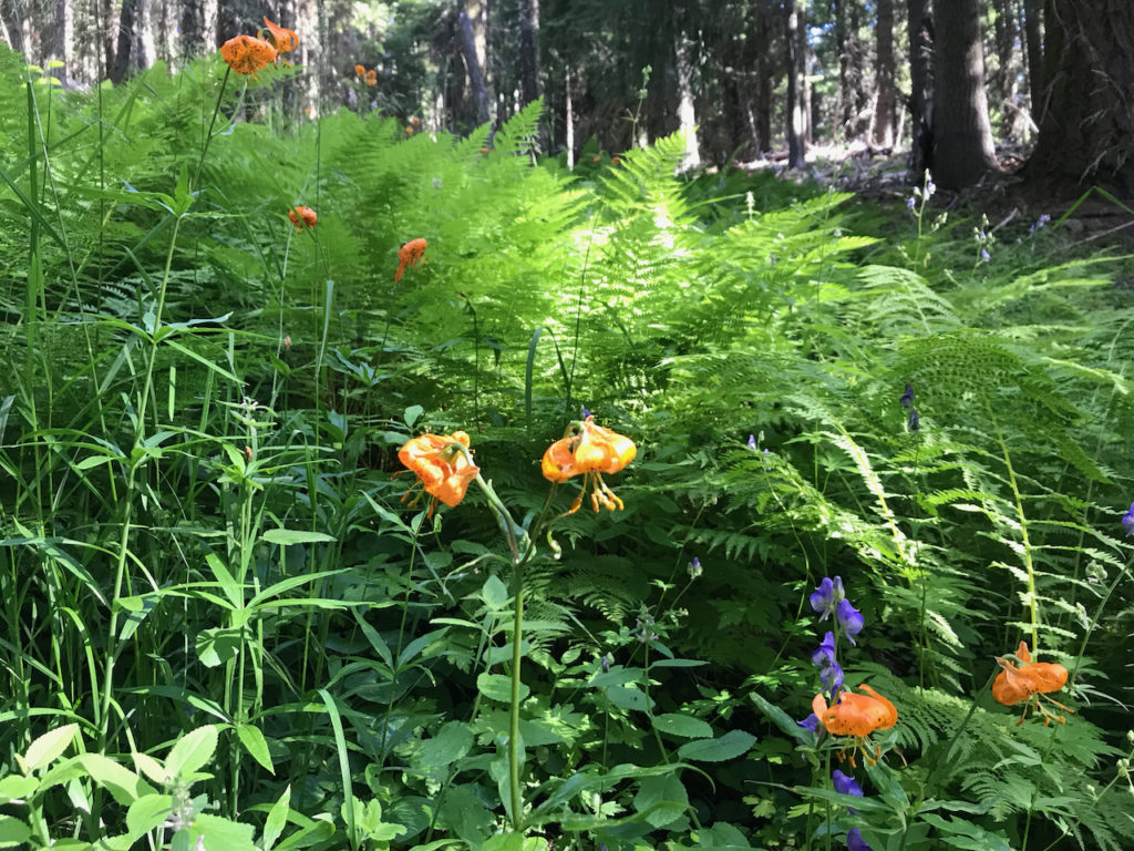
The character of the trail ranges from dry exposed slopes to lush, spring-fed ferns and flowers. Roosevelt elk, deer and bear visit this area.
The winter winds and snows are often harsh on this trail with resulting downed trees. Because of snow, access to trail crews is often limited until early summer when chainsaw restrictions are in place. Expect to have to crawl over some downed trees.
History
This trail was originally built to service the fire lookout at Wagner Butte. The lookout was abandoned and so was this trail. However, you can still see old red paint blazes on rocks and cutouts in some trees. You can still see horse pen area and old implements if you look around.
The U.S. Forest Service built the Wagner Butte fire lookout in 1923 and operated it until 1964. The Forest Service then destroyed the building in 1971 after airplanes took over most fire surveillance. For several decades the trail deteriorated to the point where it was impossible to locate while trying using an old 1953 map.
In 2005, Torsten Heycke photocopied the trail map route onto clear acetate film and slapped it on his computer screen on top of a nascent Google Earth map (a Keyhole map). He traced the route on his computer and generated a gpx file which he subsequently loaded into a GPS device. Later, in 2008, with approval from Steve Johnson from the Forest Service, AWTA was allowed to re-build the trail on the old route.
During construction, old blazes were found as well as more recent paint blazes on rocks from the 1990s when a group of Forest Service employees had thought it might include this trail in the eventual 2000 Ashland Trails Plan (it was dropped from that plan). The trail was included in the 2015 Ashland Trails Plan, cementing its legitimacy.
Written by Torsten Heycke 05/16/2020