
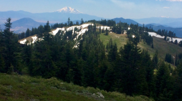
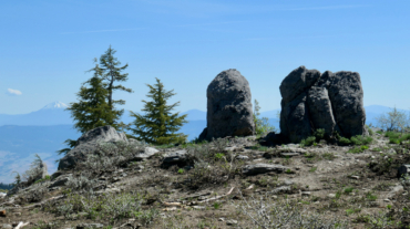
Description – Distance: ~3 miles – Min/max elev.: 6510’/7220′ – Elev. gain/loss: 751’/-1136′ Click here for routes and maps with Split Rock trail. Split Rock trail is a pede ...
Description – Distance: ~3 miles – Min/max elev.: 6510’/7220′ – Elev. gain/loss: 751’/-1136′ Click here for routes and maps with Split Rock trail. Split Rock trail is a pede ...
- Distance: 8.5 miles - Min/max elev.: 6515'/7186' - Elev. gain/loss: 1023'/-1023' Starting at Mt Ashland, head west through the Mt Ashland parking lot and onto ...
- Distance: 9.4 miles - Min/max elev.: 6519'/7187' - Elev. gain/loss: 2381'/-2381' Head north from the Split Rock TH and climb the occasionally faint and narrow ...
- Distance: 30.1 miles - Min/max elev.: 2189'/7187' - Elev. gain/loss: 6039'/-6039' Starting at Witzend, head out Waterline, up Bandersnatch to Red Queen. At th ...
- Distance: 30 miles - Min/max elev.: 4035'/7187' - Elev. gain/loss: 4345'/-4345' This loop could be started at Four Corners, Eastview TH, BullGap, Mt Ashland, or Grouse Gap. ...
- Distance: 60.15 mi (actual is closer to 62) - Min/max elev.: 2931'/7469' - Elev. gain/loss: 11,564'/-11,564' Starting at the Mt Ashland lodge, head southwest through the ...