
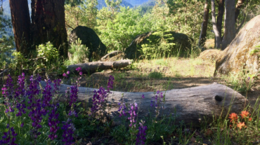
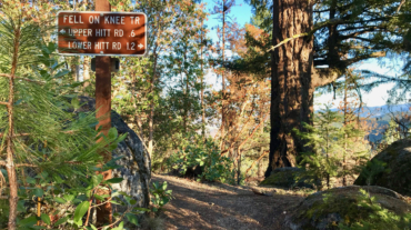
Description – Distance: ~3.3 miles – Min/max elev.: 4023’/4732′ – Elev. gain/loss: 232’/-1935′ Click here for routes and maps with Hitt Rd. Hitt Rd starts--at the low end--at ...
Description – Distance: ~3.3 miles – Min/max elev.: 4023’/4732′ – Elev. gain/loss: 232’/-1935′ Click here for routes and maps with Hitt Rd. Hitt Rd starts--at the low end--at ...
- 7.2 miles - 2,200 of vertical Start at the Fairy Pond TH parking. Head out FS Rd 2060 for ~1.7 miles to Wonder. Head up Wonder until reachin ...
- Distance: 8.2 miles - Min/max elev.: 2011'/3547' - Elev. gain/loss: 1699'/-1699 This is a pedestrian and mt bike route.From the Fairy Ponds TH, head north on ...
- Distance: 9.6 miles - Min/max elev.: 2011'/4041' - Elev. gain/loss: 2128'/-2128' - Pedestrian and Mt BikeStarting at Fairy Ponds TH, head out FS Rd 2060 for ~4.9 miles. Tur ...
- Distance: 10.8 miles - Min/max elev.: 2011'/4252' - Elev. gain/loss: 2423'/-2423' - Pedestrian and Mt Bike From the Fairy Ponds TH, head south out FS Rd ...
- Distance: 11.5 miles - Min/max elev.: 2189'/4041' - Elev. gain/loss: 2731'/-2731' This is mostly for runners who are looking for multiple uphill-downhill sect ...

- Distance: 14.6 mi - Min/max elev.: 2189'/4041' - Elev. gain/loss: 3142'/-3142' Starting at Witzend TH, head south on Glenview and then left at Granite St to join FS Rd 2060 ...
- Distance: 15.2 miles - Min/max elev.: 2011'/4252' - Elev. gain/loss: 3600'/-3600' This route is mt bike and pedestrian. NOTE: bikes must ride up Wonder. More description ...
- Distance: 15.5 miles - Min/max elev.: 2205'/4882' - Elev. gain/loss: 3148'/-3148' - Pedestrian, Mt Bike Starting at Fairy Ponds TH, head out FS Rd 2060 ...
- Distance: 15.7 miles - Min/max elev.: 2213'/4882' - Elev. gain/loss: 3070'/-3070' This is a pedestrian and mountain bike route. From Fairy P ...
- Distance: 20.5 miles - Min/max elev.: 2204'/4915' - Elev. gain/loss: 3689'/-3689' Starting at Fairy Ponds TH, head southwest out FS Rd 2060 for ~3.6 mil ...
- Distance: 60.15 mi (actual is closer to 62) - Min/max elev.: 2931'/7469' - Elev. gain/loss: 11,564'/-11,564' Starting at the Mt Ashland lodge, head southwest through the ...