
In a minute or two the Caterpillar took the hookah out of its mouth and yawned once or twice, and shook itself. Then it got down off the mushroom, and crawled away in the grass, m ...
In a minute or two the Caterpillar took the hookah out of its mouth and yawned once or twice, and shook itself. Then it got down off the mushroom, and crawled away in the grass, m ...
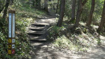
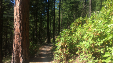
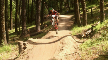
- Distance: 3.1 miles - Min/max elev.: 2762'/3359' - Elev. gain/loss: 704'/-704' From White Rabbit TH, head north on White Rabbit and then turn right onto Caterpillar trail (w ...
- Distance: 3.4 miles - Min/max elev.: 3175'/3852' - Elev. gain/loss: 732'/-732' This route starts and ends gently, but has a good steep climb in the middle. Start up the Whit ...
- Distance: 6.5 mi - Min/max elev.: 2215'/3546' - Elev. gain/loss: 1438'/-1438' Head north on Glenview and turn right on Ashland Loop Rd. After a short climb, c ...
- 5.2 miles - 1,600 ft of vertical Starting at Witzend parking, head south on Waterline and turn left up Bandernatch. Follow Bandersnatch and turn right at Red Queen (about ...
- 6.1 miles - 1400 ft of vertical Start at Witzend parking and head south on Waterline and turn right very shortly onto Snark. You’ll be above Ashland Creek for awhile. Sna ...
- Distance: 8.9 miles - Min/max elev.: 2217'/3407' - Elev. gain/loss: 2300'/-2300' Starting at Witzend, head out Waterline, up Bandersnatch, turn right at Red Q ...
- Distance: 9.1 miles - Min/max elev.: 2216'/3852' - Elev. gain/loss: 2038'/-2038' Starting at Witzend TH, head out Waterline, up Bandersnatch, turn right at Red Queen. At the ...
- Distance: 10.6 miles - Min/max elev.: 2217'/4375' - Elev. gain/loss: 2445'/-2445' Starting at Witzend, head out Waterline, up Bandersnatch, turn right at Red ...
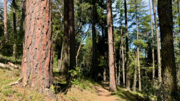
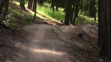
Access to Mt Ashland from Ashland is a mere 40-minutes, but the number of routes back to town are numerous with a vertical drop ranging from 4,000 to 5,000+ feet. Here are just si ...
– Distance: 11.6 miles – Min/max elev.: 2220'/6570' – Elev. gain/loss: 441'/-4800' From the Mt Ashland parking lot, head down the Bull Gap trail (for the first half-mile it is ...
- Distance: 12.3 miles - Min/max elev.: 2217'/6576' - Elev. gain/loss: 675'/-5035' From the Mt Ashland parking lot, head down the Bull Gap trail (for the first ...
- Distance: 11.8 miles - Min/max elev.: 2217'/6569' - Elev. gain/loss: 609'/-4961' This is a mostly downhill ride with a smorgasbord of cro ...
- Distance: 12.3 miles - Min/max elev.: 2216'/6575' - Elev. gain/loss: 573'/-4929' This is a mostly downhill ride with a cross-country flair. From the Mt Ashlan ...
– Distance: 16.3 miles – Min/max elev.: 2216'/6575' – Elev. gain/loss: 963'/-5322' This is a combination xc country-downhill ride featuring some double-track, narrow single-tr ...
- Distance: 14.8 miles - Min/max elev.: 2217'/7016' - Elev. gain/loss: 675'/-5021' Starting at Mt Ashland, head west through the Mt Ashland parking lot and onto ...