
Description – Distance: ~ .1 mile – Min/max elev.: 2223’/2322′ – Elev. gain/loss: 100’/-1′ Click here for routes and maps with Witzend trail. Witzend is a short pedestrian c ...
Description – Distance: ~ .1 mile – Min/max elev.: 2223’/2322′ – Elev. gain/loss: 100’/-1′ Click here for routes and maps with Witzend trail. Witzend is a short pedestrian c ...
Description – Distance: ~ 2.1 miles – Min/max elev.: 2483’/3300′ – Elev. gain/loss: 1094’/-416′ Click here for routes and maps with White Rabbi ...
Description – Distance: ~ 2.2 miles – Min/max elev.: 4905’/6623′ – Elev. gain/loss: 1855’/-140′ Click here for routes and maps with Wagner Glade trail. The pedestrian-only W ...
Description – Distance: ~1 miles – Min/max elev.: 3200’/3520′ – Elev. gain/loss: 230’/-400′ Click here for routes and maps with Toothpick trail. The Toothpick trail is flat ...
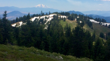
Description – Distance: ~ 3.9 miles – Min/max elev.: 4596’/7000′ – Elev. gain/loss: 208’/-2575′ Click here for routes and maps with Time Warp trail. Time Warp is a downhill- ...
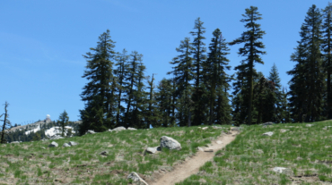
Description – Distance: ~3 miles – Min/max elev.: 6510’/7220′ – Elev. gain/loss: 751’/-1136′ Click here for routes and maps with Split Rock trail. Split Rock trail is a pede ...
Description – Distance: .8 miles – Min/max elev.: 3704’/4241′ – Elev. gain/loss: 664’/-147′ Click here for routes and maps with Ricketty trail. Ricketty connects from Horn ...
Description – Distance: ~ .25 miles – Min/max elev.: 3179’/3327′ – Elev. gain/loss: 3’/-150′ Click here for routes and maps with Rabbit Hole trail. Rabbit Hole is a short bi ...
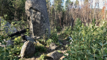
"Off with Her Head" – Queen of Hearts in Alice's Adventures in Wonderland by Lewis Carroll Description – Distance: ~ .25 miles – Min/max elev.: 3316’/3399′ – Elev. gain/lo ...
Description – Distance: ~ .5 miles – Min/max elev.: 4532’/4983′ – Elev. gain/loss: 53’/-394′ Click here for routes and maps with Potlicker trail. This multi-use trail connec ...
Description – Distance: ~ 2.3 miles – Min/max elev.: 4495’/4889′ – Elev. gain/loss: 560’/-360′ Click here for routes and maps with No Candies trail. The No Candies multi-use ...
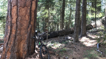
Description – Distance: ~ 2.2 miles – Min/max elev.: 4373’/5400′ – Elev. gain/loss: 176’/-1200′ Click here for routes and maps with Missing Links trail. Missing Links, somet ...
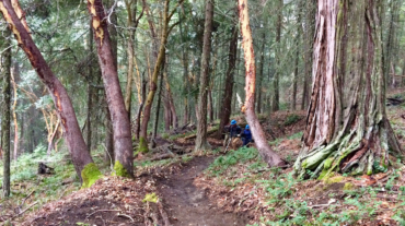
Description – Distance: ~ 1.5 miles – Min/max elev.: 2488’/3390′ – Elev. gain/loss: 975’/-75′ Click here for routes and maps with Mike Uhtoff trail. The Mike Uhtoff trail is ...
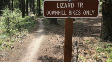
“the poor little juror (it was Bill, the Lizard) could not make out at all what had become of ; so, after hunting all about for it, he was obliged to write with one finger for the ...
Description – Distance: ~ 1.3 miles – Min/max elev.: 3474’/4298′ – Elev. gain/loss: 99’/-913′ Click here for routes and maps with Martys. Marty's is, as of this writing, evo ...
Description – Distance: ~ .8 miles – Min/max elev.: 3450’/3547′ – Elev. gain/loss: 280’/-350′ Lamb Mine is a multi-use out-and-back trail that starts at Lamb Saddle, at the ...